


Art Icons
Antique Map-Ortelius 1000 or 500 Piece Puzzle
Antique Map-Ortelius 1000 or 500 Piece Puzzle
Couldn't load pickup availability
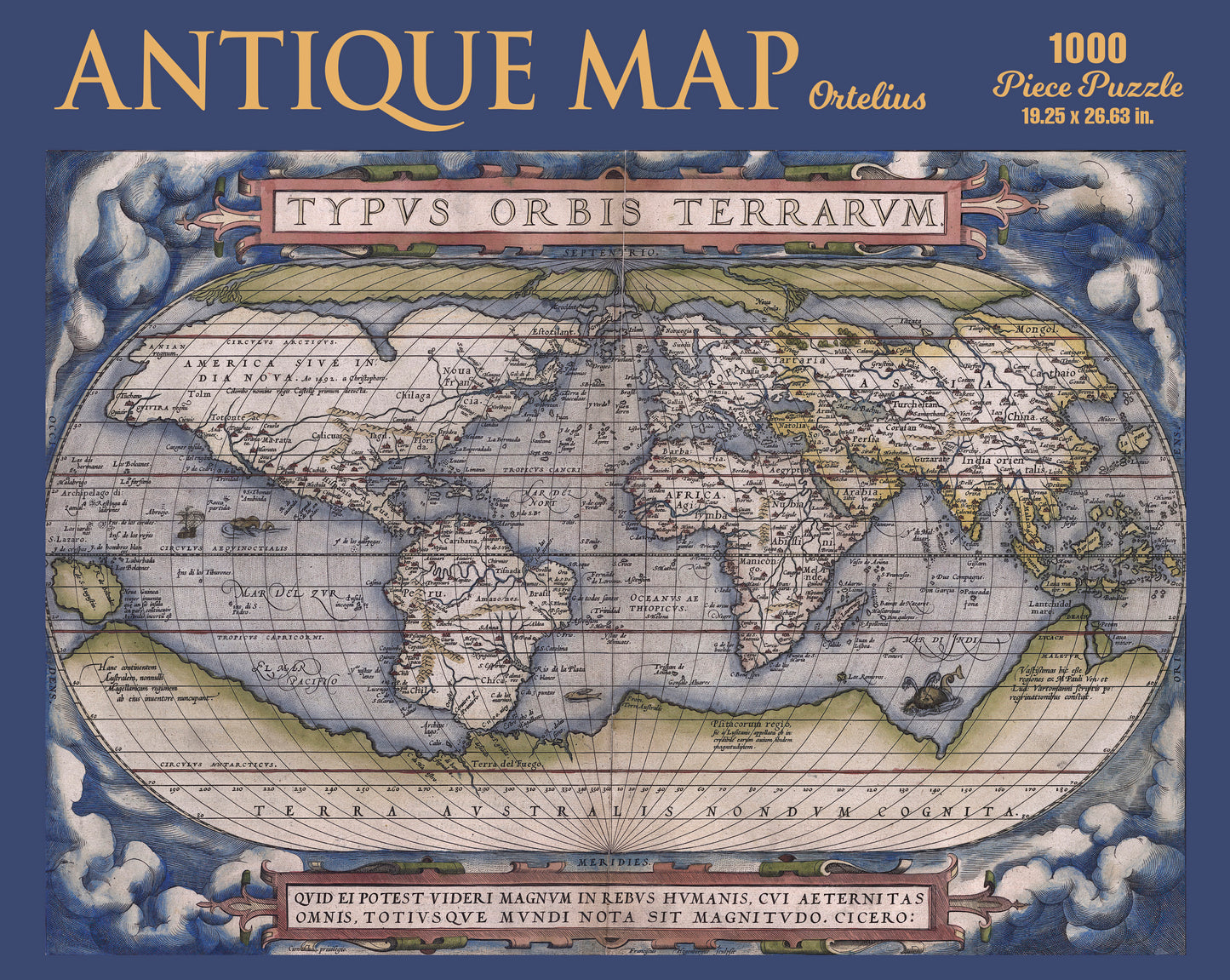
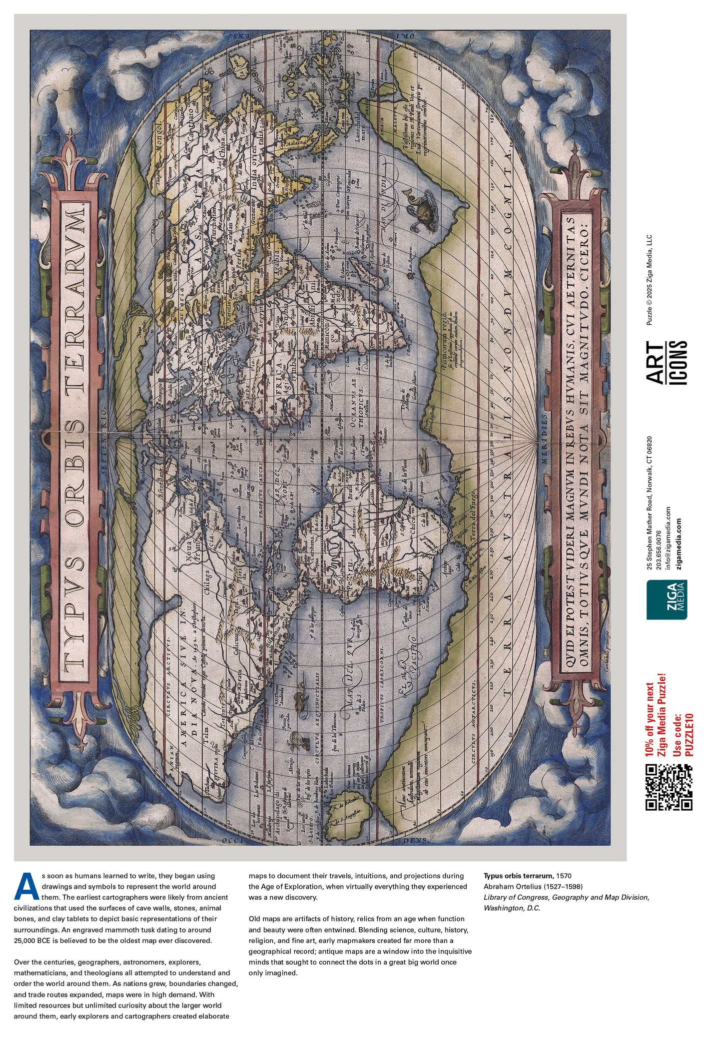
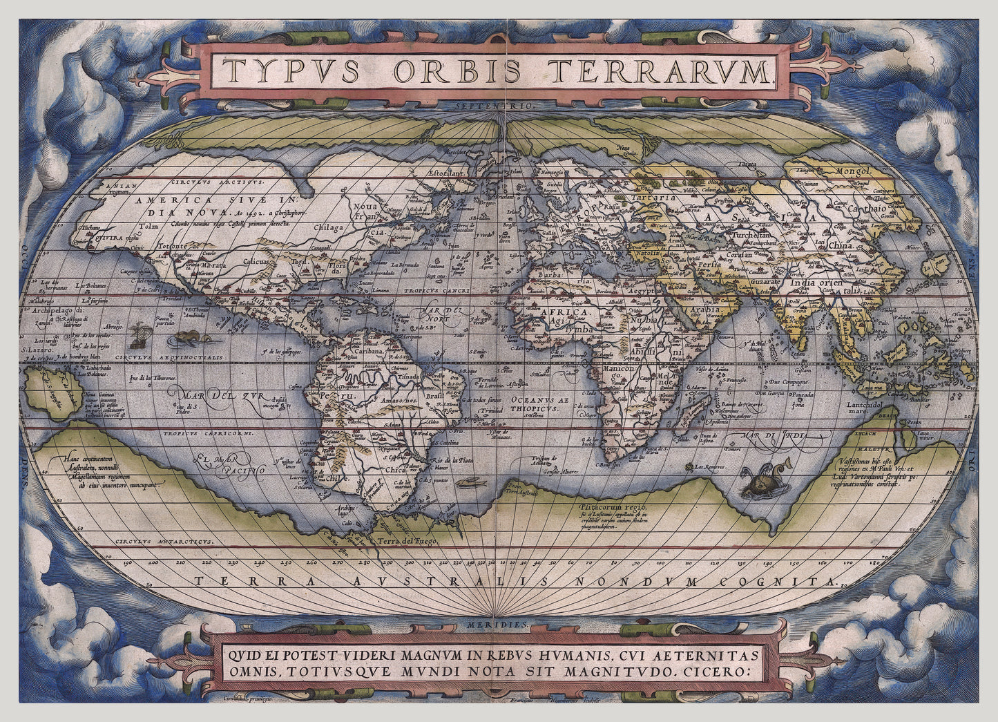
Theatrum orbis terrarum, 1570; Abraham Ortelius, 1527–1598
As soon as humans learned to write, they began using drawings and symbols to represent the world around them. The earliest cartographers were likely from ancient civilizations that used the surfaces of cave walls, stones, animal bones, and clay tablets to depict basic representations of their surroundings. An engraved mammoth tusk dating to around 25,000 BCE is believed to be the oldest map ever discovered.
Over the centuries, geographers, astronomers, explorers, mathematicians, and theologians all attempted to understand and order the world around them. As nations grew, boundaries changed, and trade routes expanded, maps were in high demand. With limited resources but unlimited curiosity about the larger world around them, early explorers and cartographers created elaborate maps to document their travels, intuitions, and projections during the Age of Exploration, when virtually everything they experienced was a new discovery.
Old maps are artifacts of history, relics from an age when function and beauty were often entwined. Blending science, culture, history, religion, and fine art, early mapmakers created far more than a geographical record; antique maps are a window into the inquisitive minds that sought to connect the dots in a great big world once
only imagined.
- Puzzle measures 18.5 x 27.75 inches
- 13 x 19 in. reference poster included
- Designed and Made in the USA
- 1000 Piece or 500 Piece Puzzle
- Landscape orientation
- Made using premium puzzle board
- Glare-free matte image
-
Perfect interlocking, random cut pieces
- Printed with eco-friendly inks
- 100% made to order the USA, ships in 3 business days!
-
Share